| Home | Occurrences | World | Europe | Germany |
| Kaiserstuhl | Limberg | Kirchberg | Strümpflekopf | Fohberg |
| Limberg bei Sasbach, Kaiserstuhl, Baden (Germany) | |
|
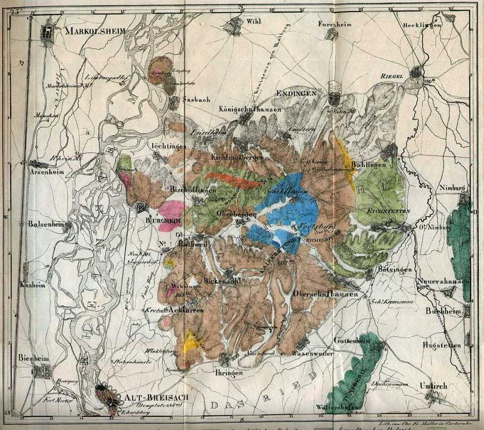
The Limberg is a hill located close to the Rhine River and N of Sasbach at the north-west part of the Kaiserstuhl. It belongs to the Kaiserstuhl volcanic complex in the upper Rhinegraben-valley. Today it is a Geoptope of Baden-Württemberg and a natural reserve area since 1973. Quarries at Limberg have been started in the first part of 19th century and the rock (Limburgite) was used mostly for the so called Tulla´sche Rheinbegradigung (Rhine-correction) from 1815-1870. It should be mentioned that in older Literature the name Lützelberg was used. This is today a hill just south of Limberg. On the Limberg there is also a ruin of the medieval castle Limburg. Soellner (1912) gave the quarries the Numbers I. to VII., from north to south. All have been closed until the middle of 20th century. The Limberg was early in the 19th century known for Aragonite and Kreuzstein (here Phillipsite) and is the type location ( Damour, 1843) for Faujasite. For the time since about 1950 the Quarry No. I. was the most productive for Faujasite, Phillipsite, Chabazite, Offretite, Calcite, Hyalite and Montmorillonite, mostly from loose boulders in the debris slopes. The Quarries II. and VI. are mentioned in the literature for the occurrence of larger (about 2 mm) Faujasite crystals, while the quarry VII. is famous for Aragonite crystals, up to a few centimeters long, on Calcite. |
|
| Limberg Faujasite Phillipsite Chabazite Offretite Hyalite Dolomite Calcite Aragonite Montmorillonite Paragenesis Literature |
 |
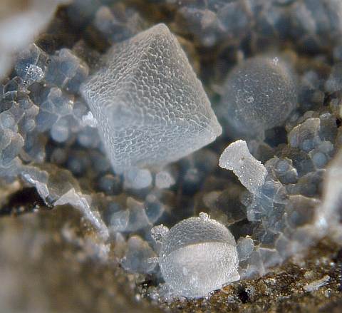
| Home | A small vug in Limburgite from Quarry I, with a Faujasite octahedron, a Phillipsite hemisphere and a Offretite aggragate. Field of view about 2 mm |

